


Ellisforde Voting District, Okanogan County, Washington
About
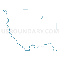
Outline

Summary
| Unique Area Identifier | 687793 |
| Name | Ellisforde Voting District |
| County | Okanogan County |
| State | Washington |
| Area (square miles) | 2.83 |
| Land Area (square miles) | 2.49 |
| Water Area (square miles) | 0.34 |
| % of Land Area | 88.06 |
| % of Water Area | 11.94 |
| Latitude of the Internal Point | 48.79631630 |
| Longtitude of the Internal Point | -119.40857590 |
Maps


Graphs
Select a template below for downloading or customizing gragh for Ellisforde Voting District, Okanogan County, Washington


Neighbors
Neighoring Voting District (by Name) Neighboring Voting District on the Map
- Antoine Creek Voting District, Okanogan County, WA
- Highway Voting District, Okanogan County, WA
- Horseshoe Lake Voting District, Okanogan County, WA
- Lake Andrews Voting District, Okanogan County, WA
- Pickens Mtn Voting District, Okanogan County, WA
- South Oroville Voting District, Okanogan County, WA
- Wannacut Voting District, Okanogan County, WA
- Whitestone Voting District, Okanogan County, WA
- Yarnell Voting District, Okanogan County, WA